The following video is a rail journey (Class 31 cab ride on 27 September 2000) from Oakenshaw North to Royston Station going through Walton, including the location of the old Walton Station (also called Walton and Sandal Station). Thanks to Michael Kaye for drawing my attention to this amazing footage. You might want to also view my earlier post about Walton’s railway infrastructure.
As a person from Walton, watching this was amazing. It was like travelling on a fairground ride that went through familiar locations.
It was hard to see things out of the peripheral vision, but did notice the following (time stamps included so people know approximately when to look for key features):
Oakenshaw Viaduct (2:09)
Chevet Terrace near the old Walton Pit (can see it on the left from about 2:10-2:40)
The bridge down near Chevet Terrace / Woodyard (2:55)
Manor Estate (first glimpse on left around 2:56, can see houses on Manor Crescent at 3:33)
School Lane bridge (3:58, can see, on the right, the black wall between the newer and older bridges at about 4:01)
The new(ish) Stables Estate next to the recreation ground/Walton Park (4:10 on left)
The old Walton Station location (around 4:11, with some of the Greenside building on the right from 4:22)
Shay Lane Bridge (4:38)
“Tin Bridge” (5:02)
Spoil heap from Chevet Tunnel (5:10 on right)
Chevet Tunnel area (from about 5:31)
Chevet Tunnel Foot Bridge (6:32)
It is great to see familiar locations from such an unfamiliar angle.
Michael informs me that the number of tracks on the line was reduced due to the collapse of a viaduct within the embankment (buried at the time of widening the route). As rail traffic tailed off by that time (1982) there was no attempt to remedy the situation.
There are also some interesting comments with the video on YouTube. If you liked the video you might want to go to it on YouTube and give it a thumbs up.
Walton – The Village Where Nature Confronted The Industrial Revolution
Walton, the village where nature confronted the Industrial Revolution, is surrounded by railways.
There is of course the current express line to London that, in the past, was run by the LNER rail company.
Then there’s the old LMS line that runs past Greenside that we look towards now. I remember this line having four sets of tracks but now only has one. When I was growing up it was in regular use for transporting coal and other freight. Now, if you’re lucky, you only see the occasional train.
The final link in the rail triangle that that encloses Walton ran north west of Ryhill to the south of the Winterset reservoir, and is no longer used.
Walton once had its own railway station. This was located behind the current houses located on Greenside. You can see the location of the entrance between the white coloured cottages and the red house with bay windows. This is the location as viewed from the bridge on Shay Lane. Gardens have expanded onto land that was once part of the railway.
Next we look at Shay Lane bridge itself – notice the preponderance of black bricks. My theory is that features built in stone were built earlier and those in black bricks later. Shay lane bridge, however represents something of an anomaly. When you look back, part of at the lower bridge is built in stone. This makes me think that an older arched stone bridge was demolished when the railway was widened and the stone was left over from that.
We’re now walking down to a footbridge that goes over the railway. It’s known locally as the Tin Bridge on account of its metal structure.
Beyond the Tin Bridge there is another site of local historic interest – the Berg Quarry – presumably named after the early lords of Walton – the de Burgs It’s located on private land in the woods beyond the white houses of the Woodfield Park. I suspect that the trees are growing out of spoil excavated from the quarry that presumably created the hill that is now visible. The Berg Quarry is said to have provided the stone for Walton Hall and Charles Waterton’s famous wall that enclosed the world’s first nature reserve. It reputedly provided the stone that was used to build Sandal Castle. It later became an early version of a landfill site.
We now look at the Tin Bridge itself. It’s metal construction mirrors that of some of the other structures that we will soon come to on this stretch of railway. These are the ones constructed with black brick so the Tin Bridge is probably associated with the same era of railway development.
The next feature is another footbridge that spans a deep cutting once though to be the deepest in England. You can see the start of the cutting from the Tin Bridge. The footpath tothis bridge runs across farmland from the top of Sike Lane. The footbridge became necessary when the line was widened from 1923 to 1925. To make it wider, the entire section of hill had to be removed and the land excavated to the tunnel level.
Presumably, the footpath would previously have simply crossed the land above the tunnel.
The black bricks, that we mentioned earlier, are again evident in the pillars holding up the bridge. I would guess that all the features containing black bricks along this line were all put in place as a part of the widening process in the 1920s.
This is the view down the cutting, looking towards Walton. And, here’s the view looking in the opposite direction.
We’re now looking back up towards the cutting from a footpath near the Tin Bridge. To the right of the pylons you can just about make out a huge mound. This is some of the rubble that was excavated during the creation of the cutting. Today it is just about obscured by the trees that have reclaimed the area turning what was once an eyesore into something quite beautiful.
We now come back into the village, at the other side of the former station, to our next railway structure – School Lane Bridge, at the bottom of School Lane. Due to the widening of the line, that we mentioned earlier, the bridge complex, at this point, clearly shows the two bridge building cultures.
The first we see is the black brick addition. The bridge architecture and engineering are impressive. You can almost feel the power and industry that went into its construction.
Then we see the original stone bridge. This is an excellent position from which to view the two railway periods side by side. The architecture of this bridge is markedly different. And it provides a rather impressive gateway to Walton.
We’re now walking past The Mount on Oakenshaw Lane. This is the site of another railway structure that is no longer visible. This structure was a tunnel or bridge that connected this area to fields on the site of the current Manor estate. I guess that it would have come out here at the bottom of the hill on Manor Crescent.
My grandad said they played football on the field after using a house on The Mount for changing rooms.
I suspect that any tunnel would be very similar to the one that links Oakenshaw Lane to Chevet Terrace and Woodyard Cottages. I would guess that it would have been filled in when the rail line was widened, though this just speculation. We’ll see the tunnel to Chevet Terrace shortly.
We now head further up Oakenshaw Lane and arrive at another stone bridge. At this point the LMS and LNER lines were joined together via a ramp. Based on my Black Brick theory the stone construction might indicate that this ramp existed before the widening of the LMS line in the 1920s. The railway line here has been torn up and the route is now used as a footpath to access the nearby Sandal and Agbrigg station. Looking back you can see the bankings of the LMS line and the ramp as they converge. And on the other side of the bridge you can see the banking as it heads off towards the LNER line.
We now arrive at the point where Oakenshaw Lane crosses the LNER line. Here’s the line as it moves off towards Sandal and Agbrigg station. This is also the place where the lower LNER line And the upper LMS line also cross. Here’s the rail tunnel – again, notice the sandstone construction. And now, panning back to the road bridge.
To complicate this cluster of bridges still further, there is also the road tunnel I mentioned earlier that links Oakenshaw Lane to Chevet Terrace and Woodyard Cottages. On the other side tunnel, you can see how the black bricks were used to widen the railway at out current location. The stone tunnel is set back with the black brick structure in front of it.
We’re now at the viaduct on Oakenshaw Lane. This is where the LMS railway crossed the Barnsley Canal. As you can see, this is a stone viaduct with a more modern bridge and black bricks behind it as an add on. Again, you can see the impressive metal structure of the newer bridge juxtaposed with the stone and red brick of the older bridge.
The next bridge to be covered went under the LNER line at the other side of Walton pit. It’s former location can be viewed from the bottom of the Manor Estate. It’s another bridge that spanned the Barnsley Canal, and another one that is, unfortunately, no longer visible. The signal here marks it’s approximate location. It was an arched shaped bridge built with red bricks. If I remember correctly it was filled in during the early 1980s at around the time when the InterCity 125’s started using the line.
We now move further down this line to our final Walton railway structure – the Nine Arches viaduct on Shay Lane. As the name suggests it comprises nine arches. The central arch is mainly stone as are both ends of the bridge. It’s as if they first built the ends and the central arch and then filled in the rest with red bricks. However they built it, it’s still a very elegant structure.
So there ends our exploration of the historic features associated with Walton’s railway lines… I hope you enjoyed it.
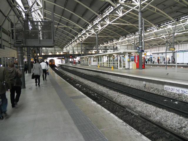
My rail journey to Leeds was ‘disrupted’ this morning. I use the word disrupted loosely because my rail journey in reality ceased to exist and became a road journey. For once it was not the fault of the rail companies but followed many months of substandard service, ostensibly following changes to the timetabling arrangements intended to create a ‘better’ service.
It turns out that today’s problem was caused by a tractor finding its way onto the railway track and damaging the associated infrastructure. This meant that the rail link between Leeds and London was severed for most of the day. The events just outside the Yorkshire village of Fitzwilliam even made it into the big time via an online article in The Guardian no less, putting ‘Fitzy’ clearly on the map: Tractor on line stops train services in Yorkshire.
While starting off about today’s incident the article then veered off into the realms of globalist propaganda designed to sway people into the ‘right’ way of thinking about the completely unrelated topic of regional government. In the atmosphere surrounding the popular backlash against the dramatic degradation of the rail service following changes to timetabling, it called for a drastic overhaul of the rail system!
The reader waited with baited breath for The Guardian’s wisdom on how to restore sanity to our vandalized and dysfunctional rail network. You were expecting it to be calling for a sensible centralised system that would give proper integration to the network. We currently have a ridiculous situation in which one company owns the tracks and infrastructure (Network Rail) and many more own the trains and rolling stock. An obvious recipe for chaos!
Instead of the obvious solution of centralisation and integration, the solution in put forward was for devolution and more localised decision making. This would make the incoherent system even worse. It would build further disintegration on an already disintegrated system of failure.
I started thinking that the decision makers might be mad. But then I remembered that the real power brokers in the world have a global rather than an national frame of reference. In our nation based mindset we do not see the full picture and assume that decision makers have lost their minds. As a result we do not see the full picture? Power in our current age is vested in global transnational corporations who see the established system of nation states as an obstacle to their quest for ever increasing wealth and power.
I have long suspected that all the rail chaos since the timetable change is deliberate. After all, simply going back to the old timetable would solve it – yet this has not been done. This points to some method in the rail madness. We now get a peek into the rationale.
The rulers in the shadows want regional government, something that the public has in many areas rejected. Regional government is government less able to control global forces and represent the public than national government. National government, from the perspective of the globalist shadow government, needs to be broken down, and states broken up into smaller more compliant units.
The reference to regional government in relation to this article suggests that the rail chaos may be one component in the globalist arsenal to attempt to bring it about even though the rail network would work best with a centralised national plan.
It is yet another example of the ‘powers that be’ getting people to voluntarily acquiesce in their own eventual servitude.